Showing posts with label North Cumbria. Show all posts

Tuesday, 6 March 2018

Tundra

At the end of February, the snow fell. And fell. The Pennine communities were snowed in with drifts higher than people. The passes were closed. The schools were closed. Even Seascale was reported to have seen snow.

Because I have always understood that it doesn't snow in Seascale, I have also understood that it doesn't snow by the sea. After my brother moved to Estonia and  I learnt that it snows by the sea there (and the sea freezes), I believed that it doesn't snow by our sea.

So, it rarely snows on the Solway coastal plain (up to and including Carlisle), and when it does snow, it isn't deep and doesn't stay long. I read something about snow on the marshes in the 1960s, and I was sceptical.

At one point on 28th February 2018, it was snowing at an inch an hour in my garden, settling at about four inches deep, or more in the little drifts. By the second day of being stuck at home, I had to escape the house and see just how close to the estuary the snow had fallen. No way was I driving down the lane - Swedish snowboots and a brisk walk would be required.

Image may contain: snow, sky, outdoor and nature Image may contain: sky, snow, tree, outdoor, nature and water
Drifts at the edge of the village

Field edge drifts

Image may contain: sky, snow, outdoor and nature Image may contain: tree, outdoor and nature
Farm lane - the milk wagon came along it a few minutes later

Lambs - we'd been surprised to see them a week earlier as they're born later in the central fells
Image may contain: sky, outdoor, nature and water Image may contain: sky, snow, tree, outdoor and nature
The monument in the snow with snow across the marshes as far as I could see

Knee deep virgin drifts. I turned back at this point.

Image may contain: snow, tree, sky, outdoor and nature Image may contain: sky, snow, outdoor and nature
A beck, with partial ice covering A creek, frozen

Image may contain: plant, snow and outdoor Image may contain: 1 person, sky, tree, cloud, outdoor and nature
Microdrift


Image may contain: sky, snow, nature and outdoor
Marshes

Image may contain: sky, cloud, snow, outdoor and nature
Marshes


Image may contain: sky, ocean, outdoor, nature and water
The path disappears into the snow sea.  The whiter lines are the creeks, filled with snow. 

Astonishing being alone in the big flat white space - reminded me of being alone in the desert. And another reminder of how unusual this landscape is for this county. I didn't get to the sea - when the path disappeared, the risk of falling in a creek was high. But it looked as though the snow went right up to the tidal limit.

The following day, the thaw began, and by 4th March the garden was thawing so quickly I could almost watch it without timelapse photography. Driving to Wigton I decided to go via Glasson, partly because the roads were more likely to be ice-free and partly because it was the last chance to see the snow by the sea. I stopped at Drumburgh minutes after the highest tide of the week, having driven the sea road open mouthed.

Image may contain: ocean, sky, outdoor, nature and water Image may contain: ocean, sky, outdoor, nature and water


Image may contain: ocean, outdoor, water and nature Image may contain: ocean, outdoor, water and nature

Danger: no bathing!

The wind was icy and I took these in about three minutes. As I took the last one, a yellow flood warning for Drumburgh came up on my phone screen, and it seemed like a good moment to move on. But I could now be certain that the snow really had gone right to the seashore.

Sunday, 13 November 2016

Rainbows over the border

Driving through the debateable lands - porous and permeable borders - reivers, smugglers, drovers

Early autumn, sunshine and morning mist, driving through the shifted border lands to see the lie of the land. Eastwards with Hadrian’s Wall, the border of AD 122; northwest to Jedburgh and Hawick and southwest along the 1237 Solway-Tweed border through Liddesdale.

This is the first time in four months that I’ve ventured over the border, although I see the other side every day. I’ve thought about it a few times: to see the Tour of Britain arrive into Castle Douglas; to look for my Scottish ancestors in Fairlie; to see the firth from the other side. I've thought about the border more - the referendum outcome and its aftermath, only two weeks after my relocation forced that - in a few years I could, in the ideas of some, be living within a few miles of the frontier of the European Union, as well as on the frontier of the roman empire.

Sunny Cumbria gives way to misty, cloudy, mizzly Northumbria, Steel Rigg’s panorama magnificent with rolling cloud behind the ridges. A factory chimney makes a dark cloud superimposed on nature’s lighter ones. At the first crossing of the Tyne, a fisherman casting in the middle of the river; by the city crossing a group of canoeists. A few days later on the radio, I heard the Tyne is now the best salmon river in England and Wales.

Having filled the car with flatpacks, I head north towards the now-distant border. The North Pennines through Redesdale to the Cheviots are rolling, lumpier and less bleak than Shap or Orton fells, but just as empty-looking, distinguished by firing ranges and grouse moors, and the site of the battle of Otterburn in 1388. As a child we knew about the permeability of the border and the ability of the border reivers to traverse it to raid livestock. But I'm not sure how much of the context we understood and I've been trying to sort that out whilst thinking about this border and other borders.

Edward I's invasions into Scotland from 1296 marked the start of 300 years of conflict in a significantly militarised zone that continued until the union of the crowns. The invasions and the allegiances of the landlords on either side of the established border left local populations well-armed and happy to plunder from their farther neighbours, without pissing in their own backyards. We understand that to mean raiding across the border, but they probably also raided other families on their own side, but less frequently - it was easier to evade punishment under another country's law than your own, even if the law of the Marches was set out to deal with cross-border crime. Some raids were economic, stealing cattle for food during the autumn raiding weeks after the summer grazing was done; some raids were tribal blood feuds; some raids were political acts.

But the porous border allowed people to cross easily for ordinary business as they do in most of the world - taking goods to sell at markets, for pilgrimage or education. Even in borders with checkpoints, local people routinely cross each day to carry out their normal business. The 300 years had periods of heightened Troubles and periods of calm, and the militarisation ebbed and flowed along with England's inclination to fight with France.

If this land was the intra-Irish border in the time of the Troubles, most of the 23 road crossings would be closed, with crossings at perhaps only the three major roads. But the big empty spaces in the middle and west Marches could still be crossed by those who knew the lie of the land, who knew the mosses and the hills and how to ride them, just as they were 500 years ago.

Across the Solway, smugglers brought goods into Scotland, an economic act driven by the differences in customs regimes between the countries. The sea border harder than the land border, but less bloody. The union of the crowns led rapidly to the end of reiving, with the vigorous removal of some of the notorious reivers and gentrification of others. Instead, the cross-border droving trade grew (along with smuggling, until the union of the parliaments), especially in the west Marches, for the next 300 years, until superseded by the railways.

The border is marked by a viewpoint, a chance to look down on Scotland. Car parks with a burger van and a huddle of bikers. Ten miles on, at the sudden and unexpectedly striking Jedburgh Abbey - saved for a future visit - I head west and then southwest via Hawick towards Liddesdale. A leaflet from the last century tells the bloody stories of the Liddesdale Armstrongs and gives me some idea of where to go to return to the great border city. Liddesdale is deserted - I pass only two other vehicles on a single track road with very many passing places. Looks like a great place to wander and lose oneself, and perhaps to wild camp - note for future reference. Empty and probably quite bleak in winter but very appealing today.

Suddenly a railway engine - this must be the heritage part of the Waverley line. The line has been restored from Edinburgh to somewhere north of Hawick, re-opening last year, but it's not clear whether it's likely to come back down here.

Crossing into Dumfries, a sign for a Carlisle estate agent - knowing that the purchase process is different in the two countries, I hadn't expected that, but maybe for the estate agent the difference isn't so great - just operating a closing date and working with the buyer's solicitor more than with the buyer? I hadn't thought of Carlisle being the urban population centre in the western borderlands south and north - I expected the border to be harder than it maybe is. But I could easily enough live here and travel to Carlisle to work, crossing the border daily (and be able to vote in any second referendum). When I got to Newcastleton, running out of fuel, I wondered which country the nearest petrol station was in, and where Newcastleton looked for its big town, supermarkets and estate agents - to Hawick or to Carlisle? Detoured towards Gretna on the offchance of fuel, thinking still of the power of the border and the differences in legal systems, the reason the English know of Gretna.

Crossing back into Cumbria, to the east a rainbow with one foot in each country; later, turning south of the firth, a half rainbow rooted in Eskmouth.

Tuesday, 20 September 2016

To the Sea!

Dead King Ed - Creeks and curlews - time and tide - cow-whispering

Late afternoon of a late August day waiting for the non-delivery of a new fridge, I took the carpenter to the seaside to see his marshes. The monument marking the place where King Edward I died in camp on the marshes is not that interesting architecturally, but it's historically important and it's down our road-end, on our marshes. This is where I came on referendum day, watching the sun set between England and Scotland.

We walked down our lanes of hawberries, blackberries, elderberries, past the strange long-eared sheep, the strange bulldog-faced barrel-shaped sheep, the strange big-balled sheep.

The monument is a 19th century copy of an original dating from 1685, marking the spot where King Edward died whilst attempting to cross the firth to hammer the Scots once again, despite a long illness. His body was returned to St Michael's church where it remained for a week before setting off to Westminster Abbey for burial. Unexpectedly, the gate in the monument was unlocked, and we inspected the Victorian graffiti before heading out across the marsh, through the wary cows to the sea.

 
Marsh, cows, monument  Marsh, cow, monument
 
Referendum day
 
Dedication
 
189-  1885 


The rough marsh is crossed by creeks and creek-ponds, some narrow and easily jumpable, others wider and acting as paths to the sea. The wider ones have cow crossings - for the buffalo of the Solway-Serengeti, too muddy for humans in sandals - and occasional bridges. A snipe takes off suddenly from one of the creeks, copying the wheatears that take off from grass hummocks as we get too close. The rough grass suddenly changes to smooth grass, but it doesn't look remotely smooth enough to make a football pitch, or a tennis court, from - we understand that Solway turf is used at Brunton Park, old Wembley and Wimbledon.

Creek pool  Creek pool 


Cow creek  Saltmarsh


As we reach the beach, the creeks get wider, with proper saltmarsh vegetation, now looking more like north Norfolk. The beach-edge consists of mudcliffs 6-8 feet high, with big chunks fallen off, settled, grass growing on one side, seaweed on another.


Mudcliffs  Lump 


We cross the rippled muddy sand to the channel of the Eden, looking at the birds beyond - mainly gulls with curlew behind; eventually we see lapwing too. As soon as we reach the riveredge we realise it's moving outward quite quickly - the tide must be coming in.

Touching my toes  Surrounded within 1 minute 

This far up the estuary, the tide comes in in only two hours, and then takes more than 12 hours to go out again.

Before  25 minutes later 


Heading back inland, the carpenter tries his hand at cow-whispering, and a herd of bullocks follow us back to the fieldgate.


Sulky cow  Determined cows 


Strange sheep  Family portrait 


Late afternoon of an early September day mother-in-law minding, I took the carpenter back to the sea to brighten his mood. Sunnier than our previous walk, this time we went from Boustead Hill, where the road is much nearer the shore, leaving the car parked on one of the scrapes beside the marsh road.

Fells from Firth  Birds and sands 


The tide was low but felt to be turning - from time to time the tide, river current and breeze combine to make striking wave patterns going upstream in the middle of the river channel. After a while two great crested grebe come down the river and ride the waves - we imagine them doing this every day just for a laugh.


And the cows licked the car.


Wednesday, 24 August 2016

Everyday serenity

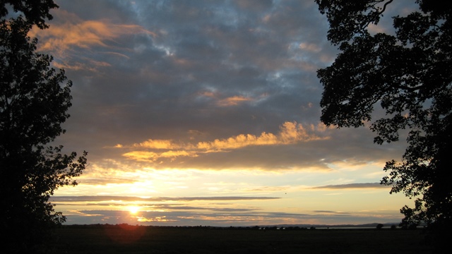
#SolwaySunset - #Vegart

Tonight I spent more than an hour watering the polytunnel, pulling up nettles and photographing the produce. And squealing when I narrowly avoided standing on the hedgehog. All slowed down, and better than doing the ironing.


When I'd done, it was sunset. Cracking view, as the neighbour said. This is the view from my brother-in-law's front drive. This is what he has, every day of the year (it rains sometimes - but it's still a great view then, just moodier).